Block Island is a pretty cool place, but I thought it would be even cooler as a volcano.
The Map
While I was looking around in a cartography forum, I discovered a little program called Wilbur that imports, exports, and edits terrain data. It has a lot of cool tools that will simulate erosion, show watersheds, etc. It’s used a lot by people who make fantasy maps to help them create realistic features. I decided to play around with it by turning Block Island into a volcanic island.
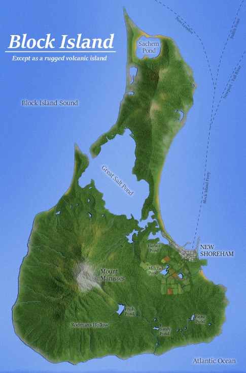
For those who are unfamiliar, Block Island is a small island off the coast of Rhode Island. Except for the cliffs along the coast, it’s very flat.

The Data
I used Google Maps as the source for the coastline and place names. I basically made everything else up.
The Method
After working through some Wilbur tutorials, I created a very rough elevation map and imported into Wilbur.

Then in Wilbur I added some erosion to make a hillshade and river layer.

I finished the map in GIMP with a mixture of freehand tools and filters to add texture. The place names are based on real locations in Block Island. I decided to name the mountain Mount Manisses after the Niantic name for the island. I debated whether I should have more of the island developed or not, but ultimately decided to limit it to a small town and farms to maintain the “rugged” look that I was going for. It was a lot of fun making this one – I hope you like it!
Wow!! Pretty cool!!
This map you made JUST made my Call of Cthulhu adventure I am writing which centers on Block Island, absolutely perfect! 🙂
Thanks Scott! I’m glad you found it useful!